↓
 

William Gilkerson, Maritime Arts

Marine Artist

William Gilkerson, Marine Arts
William Gilkerson, Maritime Arts
  • Home
  • Prints & Lithos
    • Pirates
    • USS Constitution
    • John Paul Jones
    • A Whaling Triptych
    • Warships
    • American Whalers in the Western Arctic
    • Other Interesting Ships
    • Museum Posters
    • Charts & Maps
  • Pirates
  • Shop
  • News
  • About
    • Biography
    • Books
    • Scrimshaw
  • Contact

Category Archives: Charts and Maps

The Seas and Oceans of the World

William Gilkerson, Maritime Arts Posted on September 12, 2015 by BillSeptember 29, 2020
See more...
Posted in Charts and Maps, Prints & Lithos

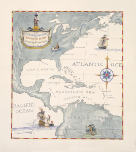
The Caribbean Sea and Spanish Main and Adjacent Waters

William Gilkerson, Maritime Arts Posted on September 12, 2015 by BillSeptember 29, 2020
See more...
Posted in Charts and Maps, Prints & Lithos

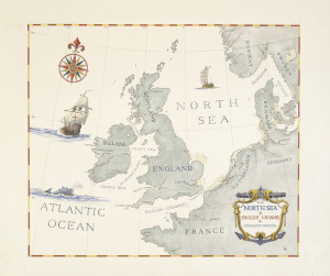
Nautical chart of the North Sea, English Channel and Adjacent Waters

William Gilkerson, Maritime Arts Posted on December 15, 2012 by BillSeptember 30, 2020

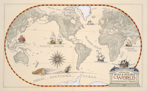
                            Old style sea chart of the North Atlantic as depicted in the book “A Thousand Years of Pirates” by William Gilkerson

See more...
Posted in Charts and Maps, Pirates, Prints & Lithos
©2025 - William Gilkerson, Maritime Arts
↑